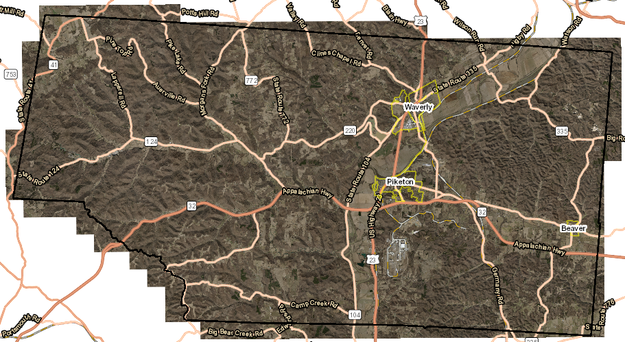
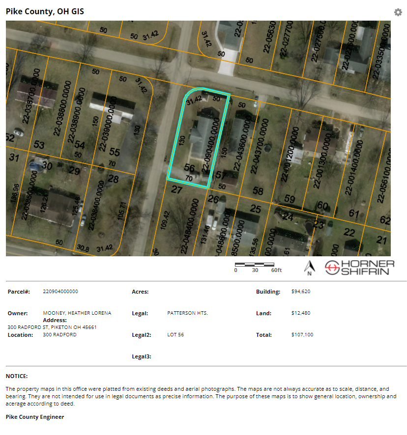
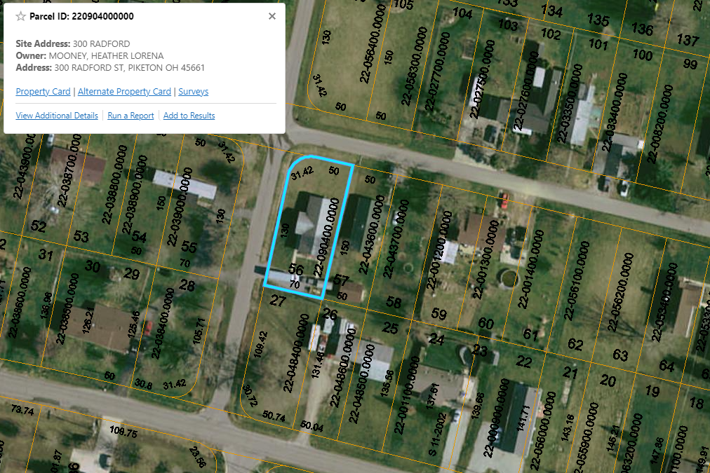
Overview
Horner & Shifrin was retained by Pike County, Ohio to provide a GIS solution with an online, multi-user application allowing the staff and public to have real-time access to map data, which would be easy to deploy, backed up and cost-effective. In addition, H&S updates the parcel system on a monthly basis from files received from the county and migrates it into the GIS system.
Once the Pike County, Ohio Skyview GIS system was structured, the staff and public were able to access map data such as parcel, addresses, municipal boundaries, sections, townships, land use, soils, multiple imagery layers and FEMA Flood Boundaries, etc. from any workstation throughout their offices and from any cellular enabled mobile devices such as Apple iPads.