Overview
The Rock Creek Public Sewer District (RCPSD) encompasses approximately 30 square miles with its wastewater treatment facility located on the Mississippi River at Kimmswick, Missouri. Our team has worked closely with RCPSD staff over the last decade providing engineering support, GIS support / application development, and embedded staff for field operations.
The District retained the services of Horner & Shifrin to provide district wide mapping and infiltration and inflow (I&I) investigation, flow monitoring, GIS development, and sewer system evaluation study to prioritize areas for further field investigations. The initial study analyzed I&I into the system and evaluated and recommended repairs or replacements to reduce infiltration and inflow and restore the sewer system structural integrity.
Critical aspects of the project included:
Phased Multi-Year Approach – Mapped and analyzed an estimated 4,500 connected sanitary manholes using source data from district provided paper-based plans and various electronic files.
Flow and Rainfall Monitoring – Four rain gauges and 14 flow meters were placed in the District boundaries and monitored for 60 days to quantify sanitary base and I&I flows from specific watersheds and total flows to the wastewater treatment plant.
GIS Database – Developed a database of system attributes (location, sizes, physical condition, etc.) of the existing sewer system and defined shape files for import into the District’s GIS database system, Pictometry.
Mapping – Conducted GPS survey of manholes and other sewer system structures. Downloaded survey data in GIS and created sewer mapping system in CAD. Developed shape files for linking sewer map to Pictometry.
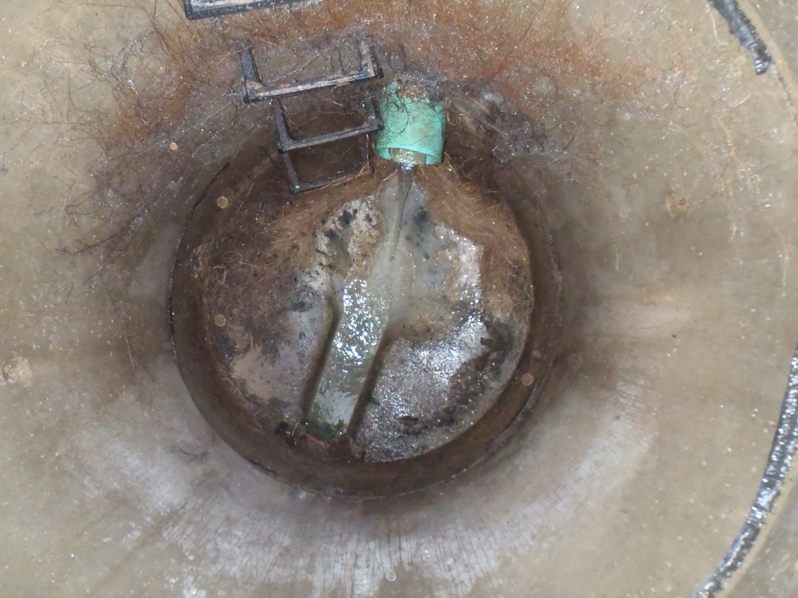
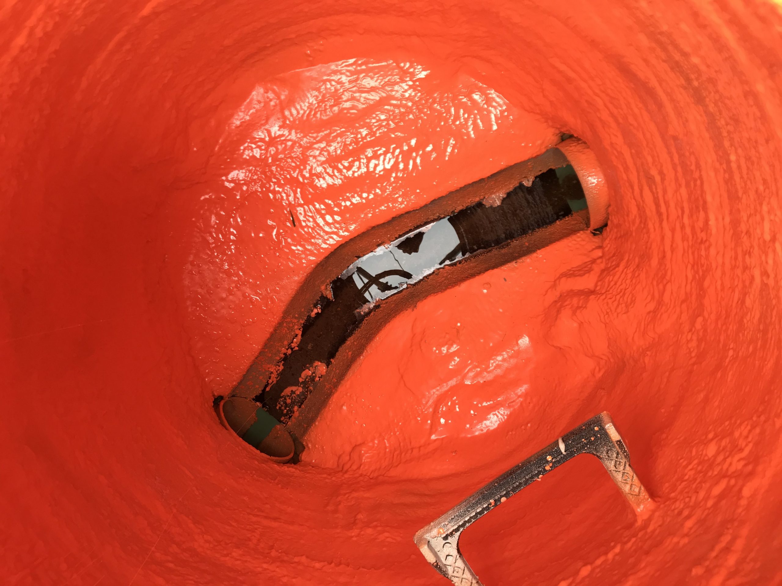
Manhole Inspections – Conducted approximately 2,000 detailed manhole inspections identifying physical and structural conditions, and sources of possible I/I. All inspection notes, photographs, etc. are linked to the GIS database.
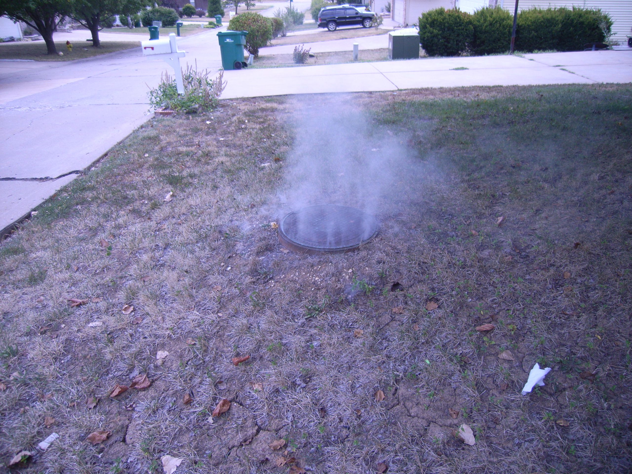
Smoke Testing – Conducted smoke testing on approximately 500,000 feet of sewers. Public and private defects and possible I/I locations were documented and entered into the GIS database system.
Dye Water Testing – Follow-up dye water testing of suspected I/I sources were performed to verify direct connection to the sanitary sewer system.
CCTV Inspection – Identified specific sewer reaches that were inspected by the District’s CCTV crew based on data gathered from manhole/visual pipe inspections and smoke testing.
Final I/I Report – Performed water balance on defects; cost effective analysis for rehabilitation/replacement alternatives; and prioritized repair/replacement/rehabilitation schedules for implementation by the District.