Overview
Terminal Railroad Association of St. Louis (TRRA), retained Horner & Shifrin for developing and implementing a comprehensive Geographic Information System (GIS) with a focus on the management of TRRA’s railroad assets and topographic field survey of railroad track and physical features. This project will utilize Cloud-based GIS services, LIDAR and other survey methods, in addition to modern day scanning technologies to convert hand drafted maps that are almost 100 years old.
Key aspects of the project:
– Scan approximately 775 track and land cloth maps
– Incorporate scanned maps (PDF) and county parcel data from 4 counties into
– Cloud-based GIS application
– Attachment of parcel/land agreements to application
– LIDAR railroad track and other railroad features
– GPS and Total Station survey methods in conjunction with LIDAR survey
Our solutions to aid the project application:
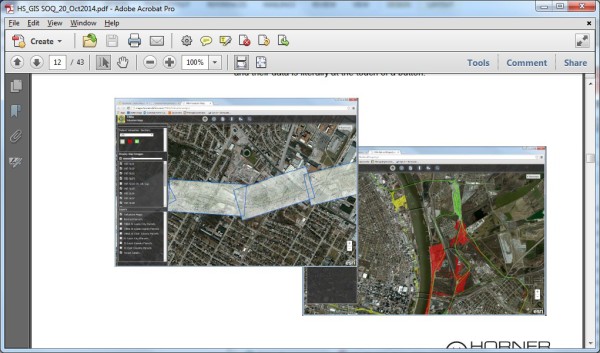
At the request of the client, H&S worked to geo-reference the scanned images over aerial imagery using transparency sliders for the client to visually see line work drawn in 1919, in relation to imagery of today.
This application can be accessed from any internet connected including desktops, laptops, iPads and iPhones, Android devices, etc. This allows the client real-time access to all maps, agreements, etc., from the office to the field and their data is literally at the touch of a button.