Overview
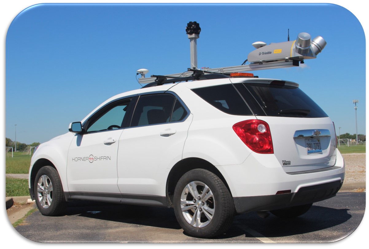
Horner & Shifrin conducted mobile LiDAR scans of 515 MoDOT bridges, located along 3,500+ miles of highway in MoDOT’s St. Louis and Southwest Missouri districts. LiDAR data and corridor images were combined to create vertical clearance diagrams for each structure.
Key aspects of the project:
– Mobile LiDAR acquisition of all 515 bridges
– LiDAR scan data collected in a manner as to not disrupt normal flow of traffic.
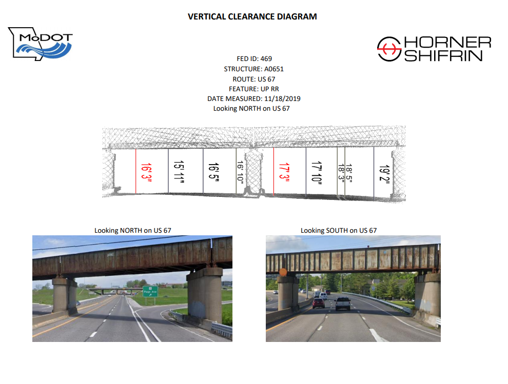
– Point cloud data needed to acquire accurate vertical clearance measurements of all bridges.
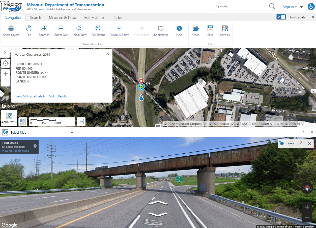
– Vertical clearance measurements generated for each bridge structure along the edge all mainline travel lanes.
– Clearance diagrams generated and delivered, electronically via PDF, per the clients’ standards.
Our solutions to aid the project application:
– At the request of the client, we were able to scan and obtain accurate point cloud data for all 515 bridges without disrupting the flow of traffic or creating any hazardous conditions for motorists, survey crews, or MoDOT road crews.
– This method of data acquisition allowed for our crew to safely collect the data in a timely manner and then process the data in-house, after all structures were scanned. Horner & Shifrin staff then generated accurate measurements, photographs, and clearance diagrams that could be delivered to the client electronically via PDF.